Saturday, 20 August 2016

DAY 35 - ALTON TO HOPPIES MARINA


Tuesday, August 15, 2016 - MI 203.2 - MI 158.5 = 44.7 miles


Today we left Alton Marina at 7:00 am for our first Mississippi lock, the Mel Price Lock and Dam just two miles south of us.  We were in and out by 7:28!  Our second and final lock on the Mississippi is 15 miles south, Lock #27 (Chain of Rocks Lock and Dam).  Both of the above locks have two chambers, a large one for tugs and a smaller one designed for recreational vehicles.  At mile 180 we are abreast of the Arch at St. Louis.  (Thinking of you to-day Brian and your St. Louis Rams).  This was a very busy and congested area with tows and barges coming at us in any direction along with barges anchored in the middle of the channel.  This was a short day on the water, arriving at Hoppies marine Services, Kimmswick, Missouri at 11:15 am.  The marina itself is a collection of low-freeboard barges with power and water.  With this being the only marina for the next 228 miles it is a favourite place to stop for us Loopers.  Kimmswick is a historic town founded in 1859.  It has quaint and charming shops and restaurants, a museum and even a scrapbooking store!  At four thirty every day Fern Hoppy (79 year old owner) gathers all the loopers visiting the marina and gives us some insight and personal knowledge about what is ahead of us on our voyage.  Only Frans and I attended but it was very informative.  We were invited to have hamburgers for supper with our looper friends, Mike and Cyndie.  The burgers were amazing.  She calls them ‘Burgers made with Love’.  Another looper boat Tom and Linda also joined us.  They are in a boat ‘Mollie B’  which…….listen…… Tom built himself!!!  It is the boat on the end in one of the pics.  Looper bedtime is 9:00 pm because we all had a busy day ahead of us.

Mel price Lock and Dam - first lock in the Mississippi River

Debris in the lock chamber

Imagination leaving the lock

Lock#27 - Doors opening on the second and last lock on the Mississippi River

Martin Luther King Memorial Bridge

St. Louis Gateway Arch

Anchored barges in the middle of the channel


Hoppies Marina

An old stone wall we saw when we walked into town

The three looper boats
Lady V, Imagination, Mollie B

Our hamburger BBQ with Michael and Cyndie Dyer

Tom (the boat builder) and his wife Linda


Monday, 15 August 2016

DAY 34 - ALTON MARINA - RAIN AND HISTORY DAY

It is Monday, August 15, 2016 and it is raining and foggy so we are staying put today.  Laundry is on the agenda. We had breakfast on board and lunch at the little restaurant at the marina.  After lunch we had a great walk around town.  It is very unfortunate that there so many closed stores on every street because Alton, incorporated as a city in 1837 has so much history - Lewis and Clark Tower, Melvin Price Locks and Dam, Miles Davis birthplace,  Lincoln-Douglas debate,  Riverview Park and Alton's 'Gentle Giant' Robert Wadlow who died as the tallest man in the world, reaching 8' 11.1".

A tug boat passing under the Lewis Clark Bridge

The Argosy Casino and the dark clouds bringing us more rain.

This grey structure contains more than 150 gage stations. From these stations the US
Army Corps of Engineers regulate the water flow in the region to promote navigation, water
supply, erosion control and to help prepare for situations such as flood and droughts.

The height the water reached in the 1993 flood

Miles Davis, one of the most influential American
jazz musicians was born here.

The Lincoln-Douglas Debate 1858
Lincoln beat Douglas in the 1860 Presidential election.

The walls of the Old City Hall

A cobble stone street in Alton, Illinois

A cypress tree - This species will not survive
in the Toronto Area


Sunday, 14 August 2016

DAY 33 - GRAFTON TO ALTON

GRAFTON TO ALTON (M 218 TO M 202 = 16 MILES)


It is Sunday, August 14, 2016 and we were allowed to sleep in.  Today as we leave the dock for our next marina we are on the Mississippi River starting at mile 218.  We are going 16 miles south to a marina closer to our next lock which we will do tomorrow.  The Alton Marina is very nice and very unusual because of all of the covered slips.  They are to protect the boats from the rain and the sun. Both Grafton and Alton can get severe rains and flooding so all of the buildings and docks float to protect them from a major disaster.  We got diesel and received a discount because we are Boat U.S. members.  The family run grocery store offers free pickup for boaters from the marina so we picked up some provisions and had a tour of the town.  Imagination came in at about 4:30.  We will be travelling with them for a few days up the river.  The closest restaurant to us for dinner was in the casino.  After dinner as we walked down to the roulette table #29 came up.  I guess a good omen so Frans put some money down.  We always play the last number that came up which was #14.  It came up a second and third time in a row!!! It was time to walk away a winner which is exactly what we did.  A great way to end an evening.

The beautiful bluffs on the way to Alton Marina on the Mississippi River

Frans putting the antenna back up.
Our lowest bridge now will be 62' high.

The covered slips at the Alton Marina
Frans pulling a cart load of provisions.
Imagination - Michael and Cyndie Dyer
They will be completing their Great Loop Voyage in
Nashville, Tennassee.

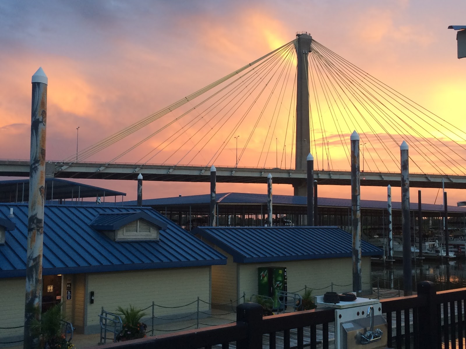
A sunset in Alton showing the New Clark Highway Bridge.
This new 'Cable-Stay' bridge spanning 4,620 feet over the Mississippi River,
linking Illinois to Missouri was completed in 1994.
It contains more than 160 miles of cable wrapped in yellow plastic.

DAY 32 - ILLINOIS VALLEY YACHT CLUB TO GRAFTON


Saturday, August 13 (M 167.9 -  M 0 = 167.9 MILES)

It was a cloudy morning when we left the yacht club at 6:50 am for the Peoria Lock and Dam just 10 miles away.  Three of us are locking through - Imagination, Tosca  (a Canadian couple also doing the Great Loop) and Lady V.  Once we exited the lock into the canal we had numerous no wake areas when passing tugs and fishing boats.  The scenery was quite nice.  We requested a bridge opening at the Beardstown RR Bridge (19’).  We were not testing our luck.  After twenty more miles we were at the Lagrange Lock and Dam at mile 80.1.  This is a wicket dam (If the water level is high the doors on this dam are lowered and you can cruise right thru without locking.) and our final lock on the Illinois River.  Our wait for a tow to go down was from 1:15 to 3:15.  When the tow was finally in the lock we were allowed to tie up to the right descending wall.

It was another lasso job!  It was finally our turn at 3:45 pm.  We are now on our way to Grafton.  There were times we could go fast and times we had to slow up for all of the smaller boats in the water considering that this was a beautiful Saturday.  We arrived a the marina in the dark and had to slip the LADY V into a 16’ 6" slip with our beam being 15’ 3".  Our large white fenders had to be replaced by the smaller back ones.  It was beer and oysters after we docked at the Oyster Bar.  This is the end of our travels on the Illinois River.  This was a fourteen hour day!


Due to the flash flooding that can occur in these areas
homes are built on tall stilts.

Nice scenery - miles and miles of this!

Erna E. Honeycutt, the tug that held us up for 2.75 hours

Look at the red buoy and the large log wrapped around it.

Large tugs use these tall wooden moorings to tie their cargo to.

The setting sun on our 14 hour day!

DAY 31 - ILLINOIS VALLEY YACHT CLUB - RAIN DAY

Today we are staying put.  There is some major weather coming through.  We had heavy rainfall from 7:30 to 9:00 with thunder and lightening.  Rained again between 4:00 and 7:30 pm.  We went to dinner again at the yacht club in the pouring rain.  After our dinner we met the commodore Chuck and is wife Kim.  Chuck had been from Peoria to Mobile many times and was willing to share some stories and advice with us.  We went outside with after dinner drinks and sat with them and many other club members.  It was a fun filled evening.  We also leant that Chuck was in the sail boat race just a week ago from Chicago to Mackinaw Island and their boat came in third!

The Gas Dock at the Illinois Yacht Club
The yellow and red floating dock you see on the left!

The weather for today!!! See our position there in the centre!

A heron on top of the breakwall

A view of LADY V from the Yacht Club with the Captain
studying on the bridge.

This is Aflac the mascot duck at the Yacht Club.
He arrived four years ago... and stayed!
Look in the background - Longest tug we have seen so far!

Friday, 12 August 2016

DAY 30 - HERITAGE HARBOR OTTAWA TO ILLINOIS VALLEY YACHT CLUB, PEORIA (74.4 MILES)

Heritage Harbor Ottawa to Illinois Valley Yacht Club, Peoria (M 167.9 - M 242.3 = 74.4 miles)

Another early morning up at 6:00 am.  We called our next lock to check the traffic situation and they were not busy.  Out we headed for Starved Rock Dam which was an hour away.  We were in and out quickly.  The channel now is much wider and you can see how low the water level is on the sides.  Depth in the channel often went down to 8.1 feet.  We overtook and passed tows going in both directions.  There is proper protocol when interacting with commercial traffic.
When overtaking (both vessels heading the same way)
‘See you on the one’ - means we overtake him on our port
‘See you on the two’ - means we overtake him on our starboard

When passing (vessels going in opposite directions)
‘See you on the one’ - means we pass port to port
‘See you on the two’ - means we pass starboard to starboard

At about noon the Lower Peoria Lake, a part of the Illinois River became very wide for the last half hour of our trip today.  We were able to open up Lady V to 24.5 knots.  
We received excellent guidance into the Illinois Valley Yacht Club via the radio on 68 because the entrance is very shallow.  We had a reading as low as 2.2 feet! Yes, again lots of mud was churned up!  After we were safely docked it is beer time!  It is really hot today 33 C, feels like 45 C. We were invited to have dinner at the yacht club and that sounded good to us.  It was very good with very friendly staff.
Starved Rock Dam and lock

Showing how low the water level is.

Abraham Lincoln Memorial Bridge

Lady V opened up at 24.5 knots on the Lower Peoria Lake


Thursday, 11 August 2016

DAY 29 - JOLIET TO OTTAWA, IL (M 287.8 - 242.3 = 36.5 MILES)


Up at dawn to leave the dock at 6:45 am to get thru the McDonough Bridge (17’) before the restricted time of 7:30 - 8:30 am when it will not open due to rush hour traffic.  We proceeded to the Brandon Gate Lock and were there at 7:00.  We had to wait for them to fill it and then going down only one valve was working so it took 35 minutes for the 34 foot descend.  The channel is wider now, no traffic so far but still a lot of ‘NO WAKE’ zones.  At 10:15 am we left Lock 4 - Dresden Lock.  We arrived at Lock 5 - Marseilles Lock at 12:00.  There was a whole slew of tows ahead of us ~ Saint Boomin’, City of Joliet and Windy City.  After an hour and a half of just drifting in the channel we finally received permission to tie up to a mooring cell.  I had to lasso the lines on.  We were finally called into the lock at 5:00 pm.  A five hour delay.  Just two miles to Heritage Harbor Ottawa.  The entrance was very shallow 3.2 - 4.5 feet.  We were churning up mud.  This is a very nice now marina and docks.  After a cold shower we had supper at the ‘Red Dog Restaurant’.  We met our first loopers Mike and Cyndie Dyer aboard ‘Imagination’, a 50’ 1979 Chris Craft.  They are almost done the Great Loop.  Their home is Nashville, Tennessee.  They had a lot of interesting stories for us which we enjoyed over a few cold beers.


Marseilles Lock - Our 5th Lock going down
Tied up to a mooring cell

Heritage Harbor Ottawa Marina Dock